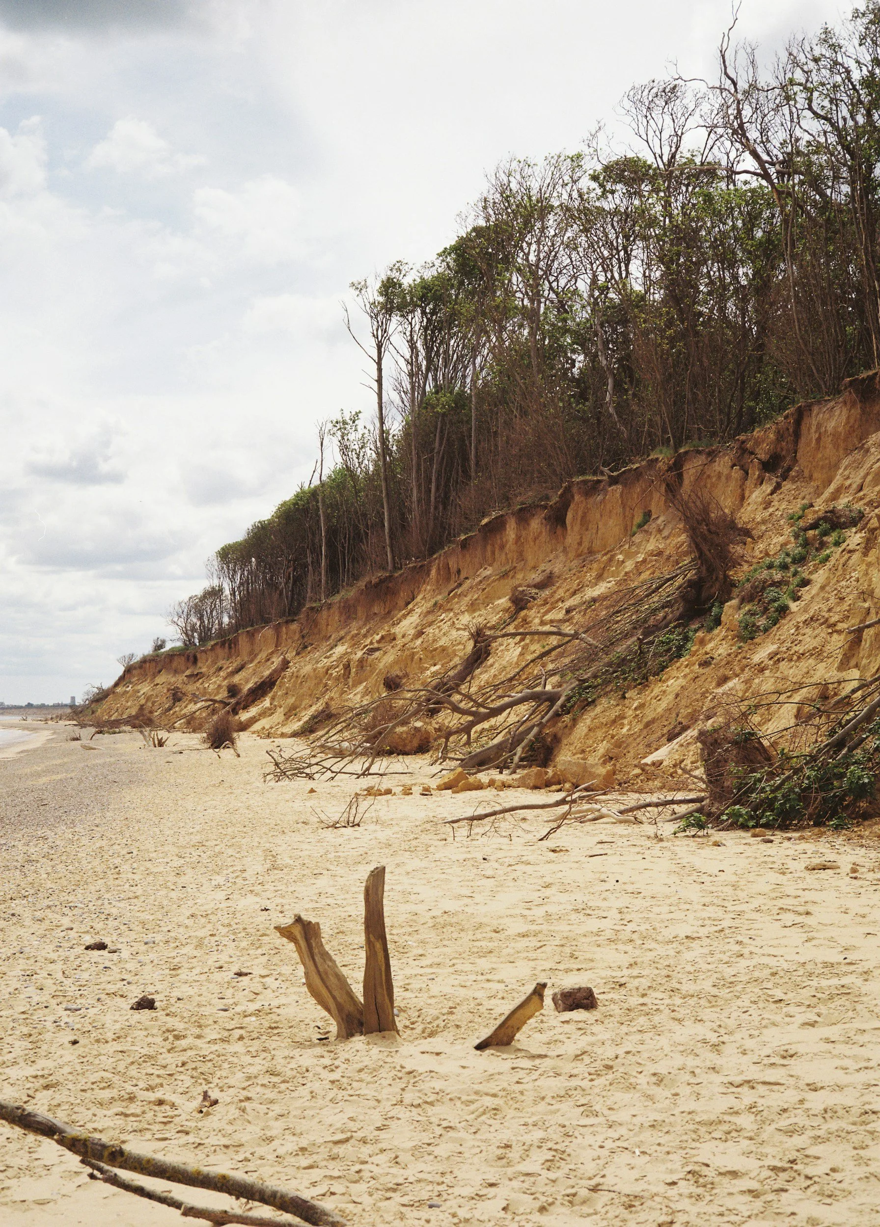
Pull up EGLE’s high risk erosion area map list and scroll to Grand Traverse County. Three entries: Acme Township, Peninsula Township, and the City of Traverse City.
That catches people off guard. The mental picture of shoreline erosion regulation up here is a sand bluff sliding into Lake Michigan somewhere past Empire — not a bay lot fifteen minutes from Front Street.
Charlevoix County, meanwhile, doesn’t appear on the list at all. Plenty of Great Lakes frontage, zero designated high risk erosion area. The line between regulated and not regulated up here has almost nothing to do with how dramatic the view is.
Grand Traverse County Is on the List. Charlevoix Isn’t.
Here’s the full Northern Michigan roll call, straight off EGLE’s page.
Leelanau: Bingham Township, Village of Empire, Glen Arbor Township, Leelanau Township, Leland Township, Suttons Bay Township. Benzie: Blaine, Crystal Lake Township, Village of Elberta, City of Frankfort, Gilmore, Lake Township. Grand Traverse: Acme, Peninsula, City of Traverse City. Antrim: Banks, City of Elk Rapids, Elk Rapids Township, Milton, Torch Lake Township.
Note what the Antrim list actually is. Those are all Grand Traverse Bay frontage townships — the east arm and the north end. The program only covers Lakes Michigan, Huron, and Superior, so the inland Chain of Lakes isn’t in it. Torch Lake Township is on that list for its bay side, not its namesake.
One Foot a Year, Fifteen Years Running
The rule itself is unglamorous. EGLE compares historic and current aerial photos county by county, measures how far the erosion hazard line has moved, and does the division.
Shoreline receding an average of one foot or more per year over at least fifteen years gets designated. That’s it. Statewide, roughly 250 miles of Michigan’s 3,288 miles of Great Lakes coastline carry the designation.
And here’s the part that matters at closing: the designation runs with the land. EGLE says so plainly — townships handed over tax ID numbers at the time of designation, parcels have been split and combined a dozen times since, and the designation follows every resulting piece anyway.
Two Lines, and Your Septic Always Gets the Far One
Every designated parcel gets two setback numbers, off the same formula. The thirty-year setback is the annual recession rate times thirty, plus fifteen feet. The sixty-year setback is the rate times sixty, plus fifteen.
Small structures get the closer line. “Small” means a foundation of 3,500 square feet or less and fewer than five living units — and it has to actually be movable, which in the rules means pilings, a basement, or a crawl space, with stud-frame or whole-log walls above grade. Slab-on-grade and masonry generally don’t qualify.
A septic system is never a readily moveable structure. The rules say so in as many words. Your drainfield gets measured against the sixty-year line, always — and on a bank receding two feet a year, that is 135 feet back from the top.
This is the quiet deal-killer on older bay and Lake Michigan cottages. The house was built in 1958 and it is fine where it sits; nobody is required to move an existing structure. But the day that 1958 septic fails, replacing it is a permitted activity measured against the far line, and on a shallow lot the buildable envelope may simply not exist.
The Setback Doesn’t Start at the Water
Buyers assume these distances run from the waterline, or from the ordinary high water mark. They don’t.
The measurement starts at the erosion hazard line — usually the top of the eroding bluff. On a high-bank lot, that can put the starting point twenty or thirty feet inland before the math even begins.
Then the slope makes it worse. On bluffs over 25 feet, the required setback gets multiplied: 1.0x at a 25% slope, 1.5x at 35%, and a full 2.0x at 45% or steeper. A 90-foot setback on a steep bank becomes 180 feet.
Nobody Has to Tell You, Because the Form Has No Line for It
We get asked all the time why something this consequential never shows up in the paperwork. The honest answer is that there is nowhere for it to go.
Michigan’s statutory Seller’s Disclosure Statement has not been substantively amended since 2006, and it contains no line item for shoreline erosion, bluff recession, high risk erosion area status, or Great Lakes setbacks. Not one. The closest thing on the form is a general question about zoning violations and nonconforming uses.
There is exactly one disclosure trigger in the whole program, and it is a permit condition rather than a seller duty: if EGLE waives part of a setback for a large structure on a substandard parcel in exchange for shore protection, that waiver has to be noted in a disclosure statement or deed. Every other designated parcel in Michigan can change hands with the buyer never hearing the phrase.
Some of These Maps Are Older Than the Buyers Reading This
The rules require EGLE to update its recession studies every ten years. Reality is thinner. The recent-studies list on EGLE’s own page runs to a handful of counties — Delta in 2022, Iosco in 2023, Gogebic in 2025, Houghton this past March.
Which cuts both directions, and the Iosco numbers are the reason to care. That restudy took the county from 15.11 designated miles down to 2.39, and from 790 designated parcels down to fourteen. Roughly 780 owners quietly stopped being regulated.
Here is the part almost nobody uses. Under the rules, a request to modify a designation can be made once every five years — or upon the sale of the property. Buying the place is one of only two events that reopens the file. If you are buying a designated parcel behind decades of armored shoreline that clearly isn’t receding a foot a year anymore, that is a real lever, and closing is your window.
This Is Not the Dune Program
Worth saying plainly, because the two get conflated constantly. High risk erosion areas live under Part 323 of NREPA. Critical dune areas live under Part 353. Different statutes, different maps, different permits, different purposes — one protects your structure from the lake, the other protects the dune from you.
A parcel can be in both. A parcel can be in one and not the other. If you followed the critical dune map redraw, understand that the erosion map is a separate document that did not get redrawn alongside it.
Also worth knowing: only two communities in Michigan administer their own high risk erosion area permitting — Alabaster Township in Iosco County and Pere Marquette Township in Mason County. Neither is up here. Every permit in Grand Traverse, Leelanau, Benzie, Antrim, and Emmet goes through EGLE directly.
The Bluff Line Test
Four questions, in order, before you write the offer on Great Lakes or Grand Traverse Bay frontage.
1. Is the parcel designated? Pull it up on MiEnviro or EGLE’s Wetlands Map Viewer — Coastal layer, High Risk Erosion Zones. Designated parcels shade light green, and clicking the parcel returns both setback numbers. Free, five minutes, and you can do it before you ever schedule a showing.
2. Where is the existing septic, and where is the sixty-year line? Not the house. The septic. Get the health department’s drawing on file and put the two numbers side by side. If the drainfield sits lakeward of the sixty-year line, you are buying a system that may not be replaceable in place.
3. How old is the study behind that number? If the county hasn’t been restudied in thirty years and the bank in front of you is riprapped and stable, the sale is your one shot at asking for a modification.
4. Is anything you plan to do a permitted activity? New construction, additions, garages, substantial reconstruction, septic installation or upgrade. Fees on EGLE’s current schedule are modest — $50 for an addition, garage, or septic, $100 for a new home or a structure relocation, $500 commercial. The fee is not the problem. The setback is.
And on enforcement: Part 323 does not carry a fine. It carries something less pleasant. EGLE petitions circuit court, and the court issues whatever order is necessary to correct the violation. Building first and apologizing later is not a strategy on a designated parcel.
What This Actually Changes
Not much, if you are buying a stable bay lot with a modern septic set well back. A lot, if you are buying a 1960s cottage on a receding bank with a system on borrowed time.
The frustrating part is how solvable it is. Every number you need is public, free, and takes about five minutes to look up — and the transaction is structured so that nobody is obligated to look it up for you.
Working this shoreline, you learn to check the map before you get attached to the view. If you are shopping Great Lakes or bay frontage this fall — around Frankfort, Suttons Bay, or anywhere on our current listings — send me the parcel number and I will pull the designation and both setbacks before you drive out.
Taylor Brown, Realtor
Taylor@taylorbrownrealtor.com
