On July 29, 2005, the Michigan Supreme Court told a woman named Joan Glass she could keep walking.
She had been walking the Lake Huron shoreline in front of a couple named Goeckel, who owned the beach and said she was trespassing. The Court of Appeals sided with the owners. The Supreme Court reversed, and the rule it wrote that morning still governs every foot of Great Lakes frontage in Northern Michigan.
The rule, in one sentence: the public can walk across your Great Lakes beach, and you cannot stop them. You still hold title to the sand. You just don't hold the right to keep people from crossing it.
And here is the part that blindsides waterfront buyers up here — it depends entirely on which water you bought.
Two Kinds of "Waterfront," Priced Like One
Grand Traverse Bay is a bay of Lake Michigan. So is Good Harbor Bay, so is Sleeping Bear Bay, so is the open shore running south out of Frankfort. All of it is Great Lakes frontage, and all of it carries a public right of passage across the beach.
Torch Lake does not. Neither does Glen Lake, Elk Lake, Lake Leelanau, Long Lake, Duck Lake or Crystal Lake. On an inland lake, riparian owners hold the bottomlands out toward the center, and there is no general public right to stroll your shoreline.
Same word in the listing remarks. Same "private frontage." Two completely different bundles of rights, and the market almost never separates them.
Elk Rapids is the cleanest illustration in the region. The village sits on Grand Traverse Bay on one side and Elk Lake on the other. Walk east and you're standing on a public trust shoreline. Walk west and you aren't. Call it a mile apart.
The same split runs through Elmwood Township and Greilickville on West Bay, through Suttons Bay village, up the shore through Omena and Northport, and around both sides of Old Mission. Bay frontage is Great Lakes frontage. A lot of buyers hear "bay" and quietly file it under "lake."
The Line Is Not the Number in the Statute
Here's where the bad advice comes from. Michigan has three different ordinary high water marks, and people mix them up constantly. Michigan Sea Grant laid all three out plainly last year.
The state OHWM is an elevation written into law. MCL 324.32502 puts Lakes Michigan and Huron at 579.8 feet above sea level on the 1955 datum — 580.5 feet once you convert to the 1985 datum EGLE uses today. That number governs permits: seawalls, docks, dredging, fill.
The local OHWM is whatever your township wrote into its zoning ordinance. Some adopt the state figure outright. Chikaming Township downstate rounds 580.5 up to a flat 581 feet, in its own words, "for ease of measurement." Grand Haven skipped the concept entirely and drew its beach overlay off a 50-year flood elevation plus 115 feet of projected shoreline recession.
The natural OHWM isn't a number at all. It's a physical mark on the ground.
And the natural one — not the statutory elevation, not the township's rounded figure — is the line that decides where the public can walk.
The Driftwood Line
The standard the Court adopted came from Wisconsin, and it reads like a field observation rather than a survey: the point where the presence and action of the water is so continuous as to leave a distinct mark, by erosion, by killing off terrestrial vegetation, or by some other easily recognized characteristic.
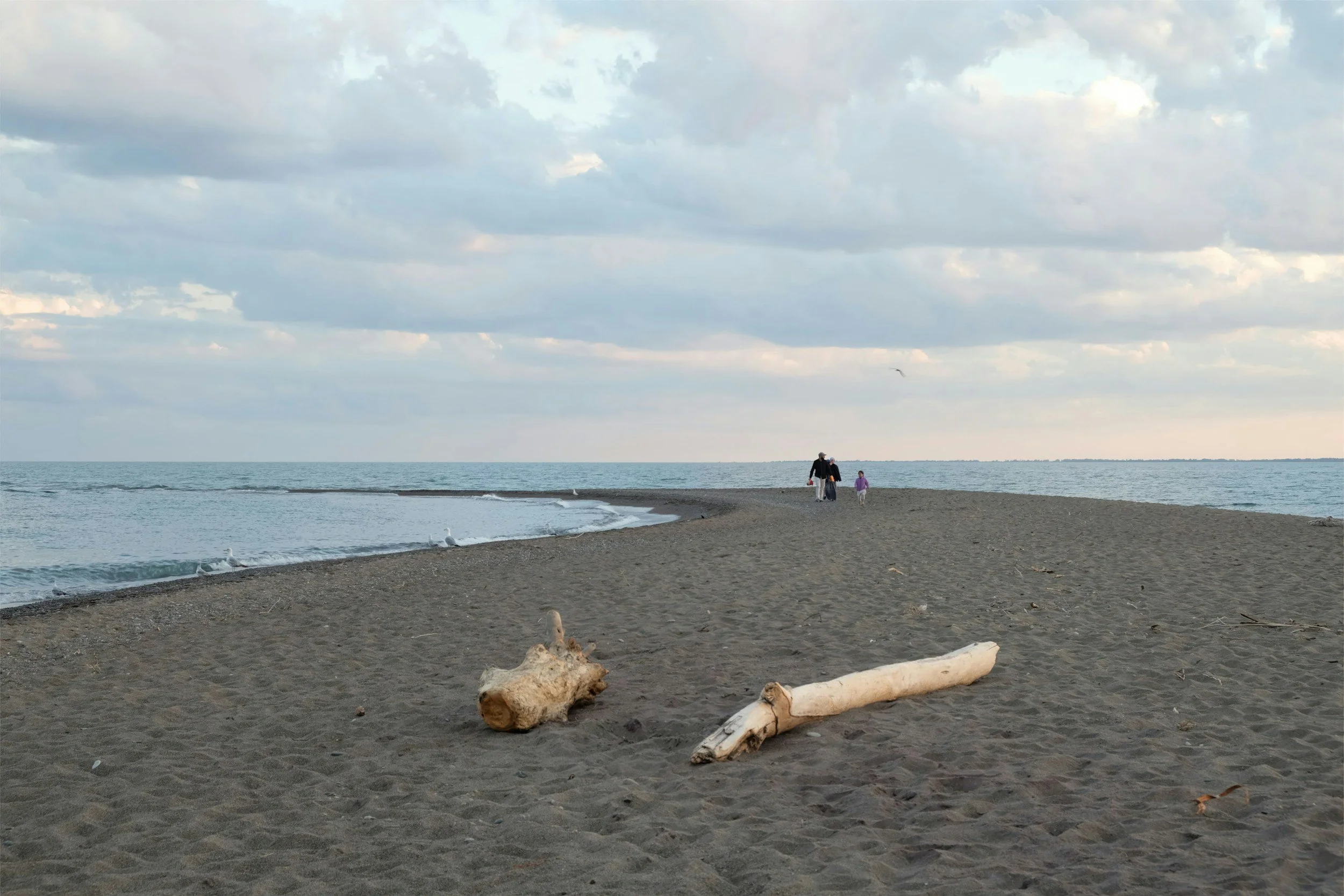
On a Leelanau or Benzie beach, that's the wrack line. The band of driftwood and dried weed and zebra mussel shell. The place where sand changes color and coarseness. The edge where beach grass gives up.
Justice Markman, dissenting, called that boundary hopelessly vague and predicted it would produce "more fences." Twenty-one years on, that's a fair description of a good stretch of Michigan shoreline.
What the Public Actually Gets — and Doesn't
The right is narrower than either camp tends to admit, and both sides overstate it in about equal measure.
The public may walk. That's the whole list. Walking was held to be inherent in the older public trust rights of fishing, hunting and navigation, which is the only reason it exists at all.
The public may not lounge, sunbathe, picnic, plant a chair, or play games below your high water mark without permission. Those aren't public trust uses. A family that sets up an umbrella on your Lake Michigan beach is not exercising anything the Supreme Court granted them.
And above the natural mark — the dry sand, the yard, the stairs — it's yours, full stop. Passage below the line is not a license to be there.
Why This Matters More This August Than It Did in 2020
Lake levels move, and the walkable strip moves with them.
Lake Michigan-Huron ran roughly an inch above its long-term average this July, per the Army Corps' Detroit District. That is a very different summer from 2019 and 2020, when record water was eating bluffs and there was hardly a beach left to argue over.
More beach means more walkable beach. The public trust line is pinned to the mark the water leaves over the long haul, not to today's water's edge — so a normal-to-low water year widens the strip between the waterline and the mark. It does not widen your private dry sand.
There's also a change coming that nearly nobody in real estate is tracking. The International Great Lakes Datum is being rebuilt. IGLD 1985 gets replaced by IGLD 2020, targeted for 2027, and elevations across the basin could shift by as much as two feet.
That won't move the driftwood — the natural mark doesn't care what datum you're on. But it will move the statutory number that township setbacks, seawall permits and critical dune determinations all measure from. We wrote about EGLE's critical dune remapping earlier this year: same shoreline, same buyer, different regulator, and now a moving yardstick underneath both.
The Driftwood Test
Three questions before you write the offer on Northern Michigan waterfront.
1. Great Lake or inland lake? If any part of the frontage touches Lake Michigan or one of its bays, the public trust attaches and passage comes with it. If it's an inland lake, it doesn't. This is a thirty-second question and it changes what you're actually buying. Don't take the listing's word for it — "bay," "shore" and "beach" all get used loosely up here.
2. Where does the beach actually change? Walk it. Find the wrack line, the vegetation edge, the color break in the sand. Then look at how much dry, private beach sits above it. On a wide Benzie or Leelanau shore that might be sixty feet of real privacy. On a narrow bluff-toe lot it might be almost nothing, and the public line effectively runs up to your stairs.
3. What does the township measure from? Pull the zoning ordinance's high water mark definition before you plan anything — a seawall, a stairway, a rebuild, a shift of the building envelope. State figure, rounded figure, or a homegrown contour, it decides your setback. With the datum change coming, that's worth confirming rather than assuming.
The Part Nobody Wants to Say Out Loud
For most buyers, none of this changes the decision.
A hundred feet of Lake Michigan frontage in Leelanau County is still a hundred feet of Lake Michigan frontage, and people have been walking these beaches since long before 2005. The number of shoreline disputes that reach a courtroom is vanishingly small next to the number of strangers who pass each other on the sand and nod.
But we see this pattern a lot in our market: a buyer pays a Great Lakes premium expecting Torch Lake seclusion, then finds out in the middle of August what they actually purchased. That's a disclosure problem, not a value problem, and it's entirely fixable by asking before you sign instead of after. Working this shoreline, you learn that "private beach" is really two questions wearing one coat — which is also why we keep coming back to how loosely the word "access" gets thrown around up here.
The buyers who end up happiest on Great Lakes frontage are the ones who wanted the water more than they wanted the fence. If that's you, the public trust doctrine is a footnote. If it isn't, there are hundreds of miles of inland shoreline across these four counties where it never applies at all.
So which one are you actually shopping for? Worth answering honestly before you fall for a view.
If you're looking at waterfront anywhere in Grand Traverse, Leelanau, Antrim or Benzie and want to know exactly which rulebook comes with the sand, ask us. We'll walk the beach with you and find the line. You can see what's currently on the market here, and we're always happy to talk through a property well before you're anywhere near an offer.
Taylor Brown, Realtor
Taylor@taylorbrownrealtor.com
